MTS Member Spotlight: Sofar Ocean
This month, we are shining light on MTS member - SOFAR Ocean, a leader in marine technology, dedicated to improving ocean health through innovative data solutions. Join us as we explore their impactful contributions to marine science and technology.
How Sofar Ocean airdrops fleets of Spotter buoys to collect real-time data in hurricanes

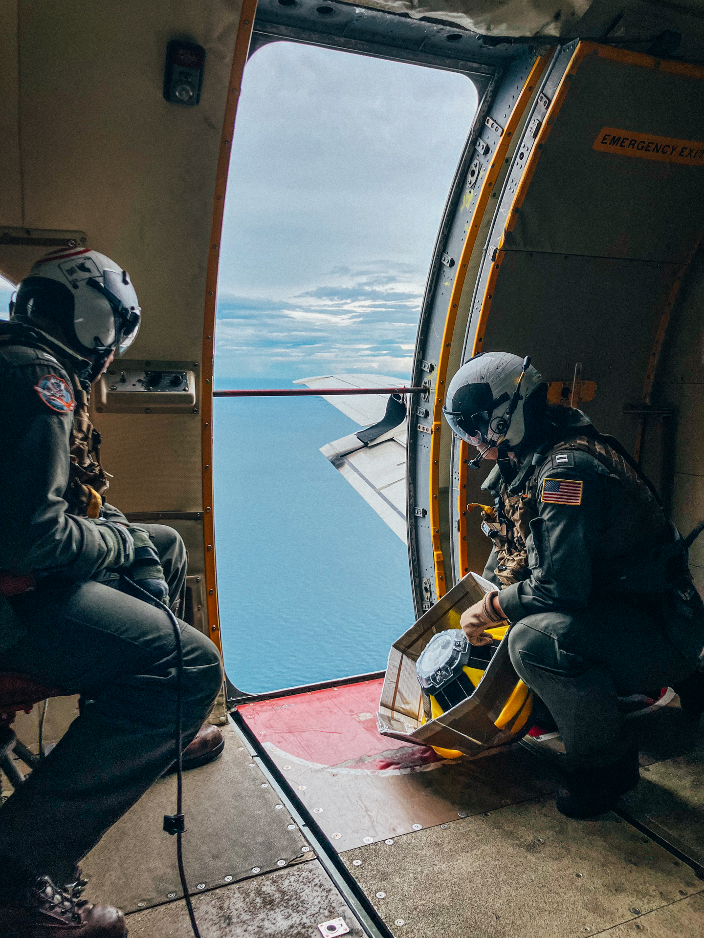
U.S. Naval Research Laboratory Scientific Development Squadron VXS-1 prepares to airdrop a Sofar Spotter buoy in the Gulf of Mexico ahead of Hurricane Idalia in 2023. Airdropped Spotters make direct, real-time observations of the extreme conditions generated by hurricanes.
Sofar Ocean is helping coastal communities and government better understand, predict, and prepare for major hurricanes in the Atlantic Ocean and Gulf of Mexico.
Sofar and its collaborators in the National Oceanographic Partnership Program (NOPP) Hurricane Coastal Impacts Project (NHCI) airdrop fleets of Spotter buoys ahead of hurricanes to make direct, real-time observations of the extreme conditions generated by storms. Each durable, basketball-sized Spotter collects and transmits wave, wind, sea surface temperature, and atmospheric pressure data at scale. These ground truth observations are extremely rare and highly valued by forecasters tasked with predicting extreme storm activity.

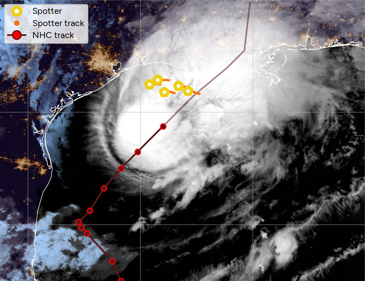
NASA/NOAA GOES-16 satellite imagery overlayed with the drift tracks (orange lines) of the five Spotter buoys (yellow pentagons) airdropped ahead of Hurricane Francine. The 6-hour National Hurricane Center track (brown line with red circles) shows the path of the storm.
On September 11, 2024, five Spotters airdropped in the Gulf made direct observations of the extreme conditions generated by Category 2 Hurricane Francine. SPOT-31983C, the easternmost buoy in the image above, passed particularly close to the storm, observing maximum wave heights of approximately 40 feet.
Learn more about Sofar's rapid response to Hurricane Francine
The Spotters airdropped by NOPP NHCI are part of Sofar's broader, global network of free-drifting Spotters. The planetary-scale data collected by this network is now used by the National Hurricane Center (NHC) to support critical warning systems for extreme weather. Access to Sofar's ground truth data, particularly in the open ocean, helps NHC enhance situational awareness, validate models, verify current conditions, and make short-term adjustments to wave forecasts.
Read more about NHC's use of Sofar data
Interested in learning how Spotter can support your next coastal resilience project? Connect with our sales team here to see how we can help.
Plus, check out our recent webinar with Paul Gayes (Coastal Carolina), who is deploying Spotters at scale to improve coastal zone monitoring in the southeastern U.S.

